Twelve 2024
AL122024 Advisory Number 3,
DISCLAIMER This is not official information or modeling, I’m just a dude on the internet. Please follow all guidance from NOAA and your local officials.
Windfield Map
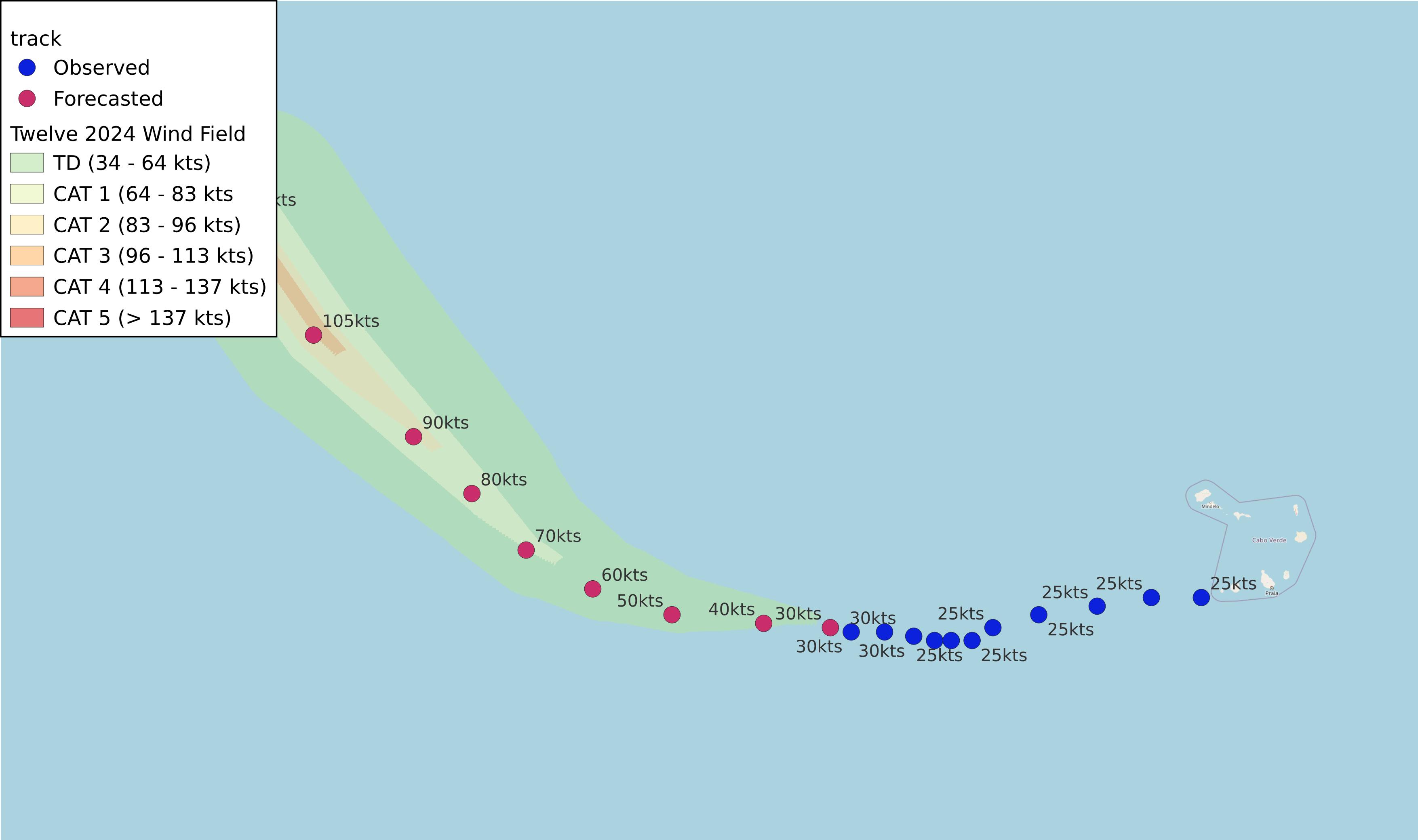
- as of 2024-09-30T09:06:54+00:00
- 100px per degree
- GWAF 0.9
- No Friction
- default radius of maximum wind is 15kts
Useful Links
- NOAA Active Cyclones
- Tropical Tidbits
- https://www.nhc.noaa.gov/text/refresh/MIATCPAT2+shtml/300838.shtml
- https://www.nhc.noaa.gov/refresh/graphics_at2+shtml/084048.shtml?cone
Data Files
File List:
twelve2024_100x100.csvtwelve2024_100x100.pngtwelve2024_100x100.wldtwelve2024_100x100_2024-09-30T090600+0000.jpeg
Official Advisory Discussion
At 500 AM AST (0900 UTC), the center of Tropical Depression Twelve was located near latitude 14.0 North, longitude 34.1 West. The depression is moving toward the west near 8 mph (13 km/h), and a general westward to west-northwestward motion is expected to continue through Tuesday. A gradual turn to the northwest is forecast by Wednesday.
Maximum sustained winds are near 35 mph (55 km/h) with higher gusts. Steady strengthening is forecast, and the depression is likely to become a hurricane by Tuesday night or Wednesday.
The estimated minimum central pressure is 1005 mb (29.68 inches).
HAZARDS AFFECTING LAND
None.
NEXT ADVISORY
Next complete advisory at 1100 AM AST.
$$ Forecaster Hagen