Isaac 2024
AL102024 Advisory Number 19,
DISCLAIMER This is not official information or modeling, I’m just a dude on the internet. Please follow all guidance from NOAA and your local officials.
Windfield Map
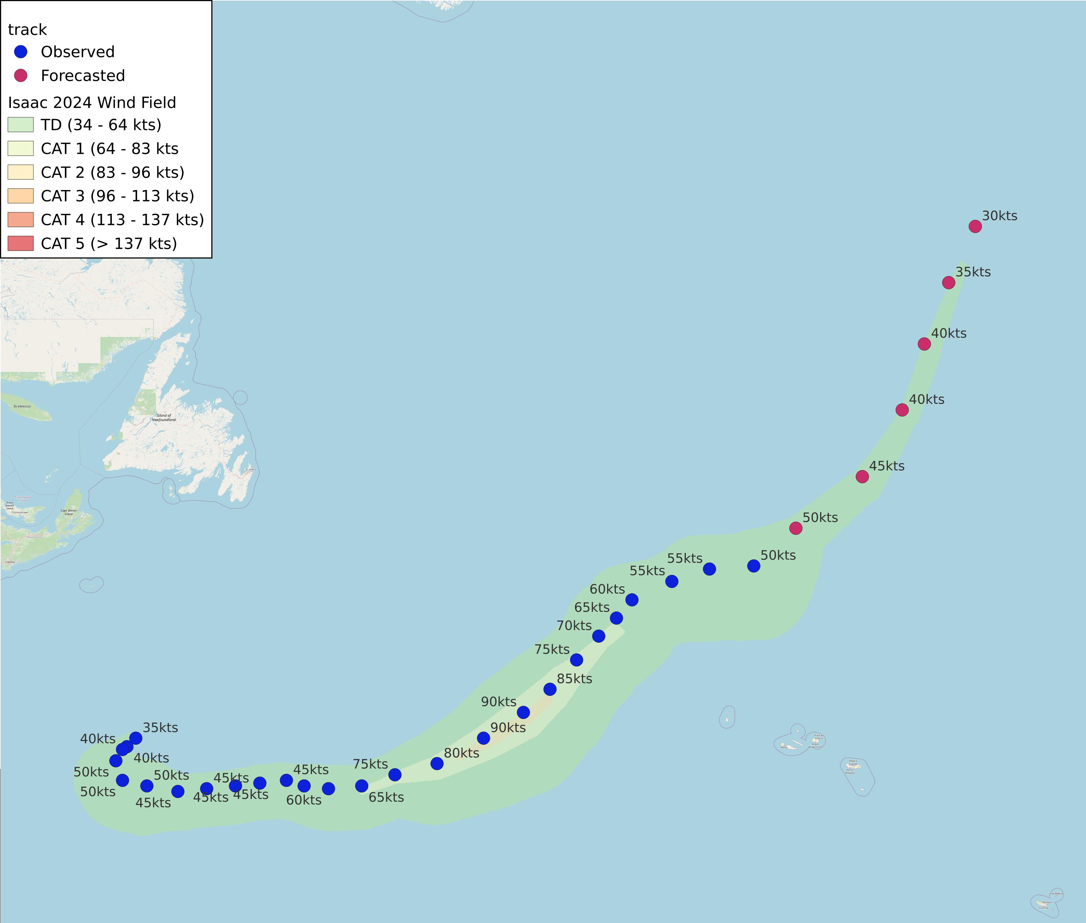
- as of 2024-09-30T15:02:40+00:00
- 100px per degree
- GWAF 0.9
- No Friction
- default radius of maximum wind is 15kts
Useful Links
- NOAA Active Cyclones
- Tropical Tidbits
- https://www.nhc.noaa.gov/text/refresh/MIATCPAT5+shtml/301453.shtml
Data Files
File List:
isaac2024_100x100.csvisaac2024_100x100.pngisaac2024_100x100.wldisaac2024_100x100_2024-09-30T150200+0000.jpeg
Official Advisory Discussion
At 300 PM GMT (1500 UTC), the center of Post-Tropical Cyclone Isaac was located near latitude 44.8 North, longitude 29.1 West. The post-tropical cyclone is moving toward the east-northeast near 17 mph (28 km/h) and a turn to the northeast is expected with a similar forward motion for the next several days.
Maximum sustained winds have decreased to near 60 mph (95 km/h) with higher gusts. Gradual weakening is forecast over the next several days.
Tropical-storm-force winds extend outward up to 185 miles (295 km) from the center.
The estimated minimum central pressure is 983 mb (29.03 inches).
HAZARDS AFFECTING LAND
SURF: Swells generated by Isaac will affect the Azores over the next few days. These swells are likely to cause life-threatening surf and rip current conditions. Please consult products from your local weather office.
NEXT ADVISORY
This is the last public advisory issued by the National Hurricane Center on this system. Additional information on this system can be found in High Seas Forecasts issued by Meteo France under WMO header FQNT50 LFPW and available on the web at www.meteofrance.com/previsions-meteo-marine/bulletin/grandlarge/ metarea2. Additional information on this system can also be found in High Seas Forecasts issued by the UK Met Office under WMO header FQNT21 EGRR and on the web at metoffice.gov.uk/weather/specialist-forecasts/coast-and-sea/high- seas-forecast/.
$$ Forecaster Papin