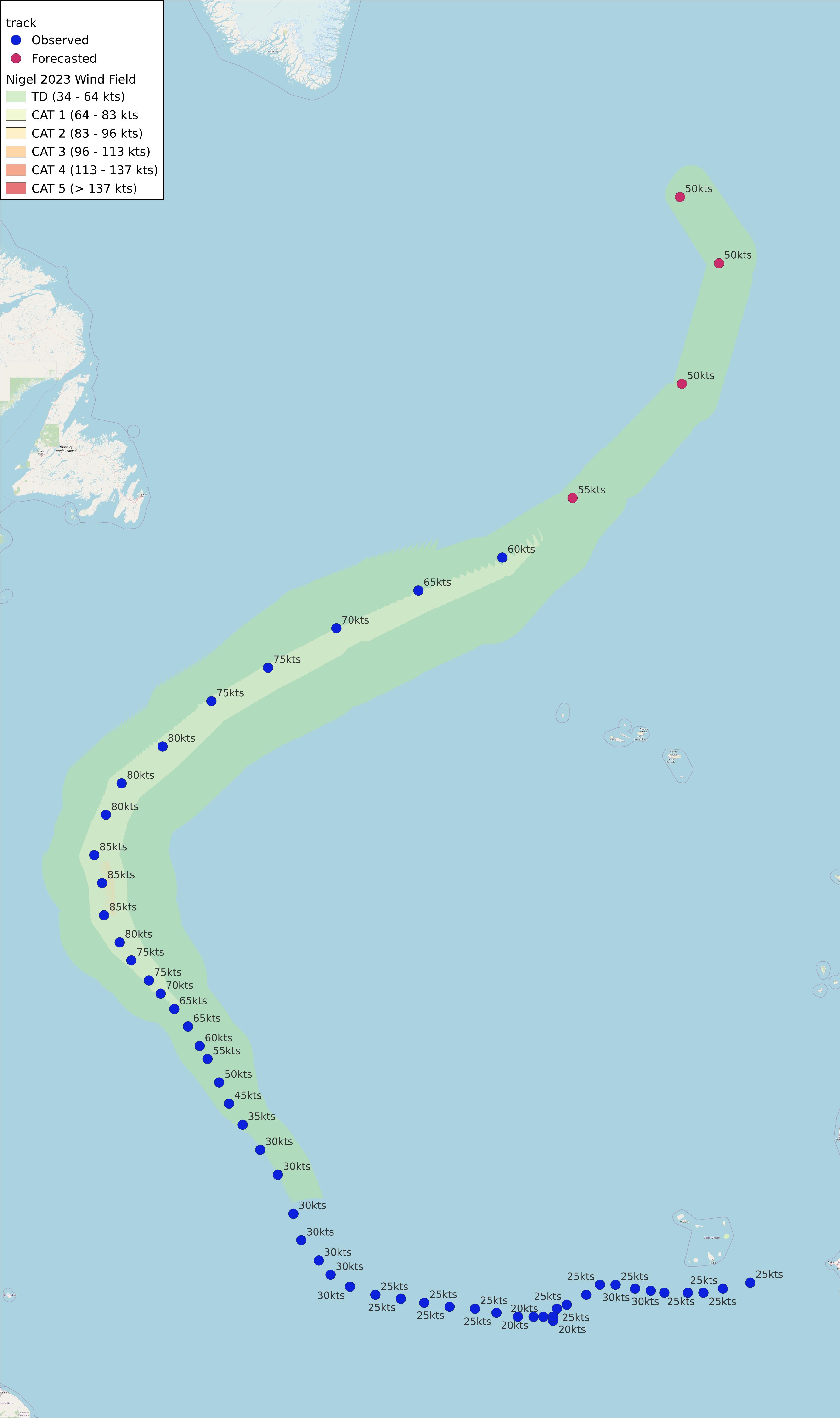
Nigel 2023
AL152023 Advisory Number 28,
DISCLAIMER This is not official information or modeling, I’m just a dude on the internet. Please follow all guidance from NOAA and your local officials.
Windfield Map

- as of 2023-09-22T09:04:39+00:00
- 100px per degree
- GWAF 0.9
- No Friction
- default radius of maximum wind is 15kts
Useful Links
- NOAA Active Cyclones
- Tropical Tidbits
- https://www.nhc.noaa.gov/text/refresh/MIATCPAT5+shtml/220834.shtml
Data Files
File List:
nigel2023_100x100.csvnigel2023_100x100.pngnigel2023_100x100.wldnigel2023_100x100_2023-09-22T090400+0000.jpeg
Official Advisory Discussion
At 900 AM GMT (0900 UTC), the center of Post-Tropical Cyclone Nigel was located near latitude 46.3 North, longitude 32.6 West. The post-tropical cyclone is moving toward the northeast near 37 mph (59 km/h), and this general motion is expected to continue for the next day or so. A slower northward or north-northwestward motion is expected this weekend.
Maximum sustained winds are near 70 mph (110 km/h) with higher gusts. Gradual weakening is forecast during the next couple of days
Tropical-storm-force winds extend outward up to 230 miles (370 km) from the center.
The estimated minimum central pressure is 976 mb (28.82 inches).
HAZARDS AFFECTING LAND
None.
NEXT ADVISORY
This is the last public advisory issued by the National Hurricane Center on this system.
$$ Forecaster Kelly